Turning your smartphone into a practical hunting tool can help you become the best hunter. To do that, you should download a few good hunting apps. But how do you choose the best apps?
I have spent a lot of time researching and trying out different apps so that you don’t have to. Check out my Top 5 list!
Best Of All: HuntStand App

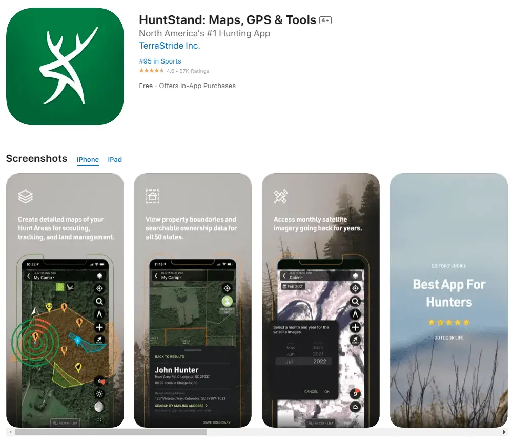
No one wants to get lost in the woods. The HuntStand App helps you avoid it. It is available for both iPhone and Android phone users, works both online and offline, and is fairly simple to use. Creating an app account gives you access to the Hunstand.com website too.
Most of all, HuntStand is a mapping app that provides you with detailed GPS satellite maps and data analytics you can use to navigate while you are on your hunting trip or just trying out your new hiking boots. Once you create your hunting area, you can alternate between satellite, terrain, and topographical maps (or their hybrids), and zoom and pan them as you like.
The best thing about HuntStand is that it is free, and you even get to use the premium features at no extra cost. However, you do have to pay a small annual fee if you want the ad-free version. Luckily, the ads do not pop up too often, so if you are on a tight budget, you can stick to the free version.
I like how easy it is to add waypoints and landmarks by pressing a bit longer on the location you want to preserve and choosing the appropriate icon. It enables you to find any place easily the next time around.
Numerous other tools for measuring distance or acreage and creating trails on the go make this a great hiking app too. I must warn you, though, that the trace function is a bit hard to find since it is not in the main toolbar.
I am wowed by the wind-tracking feature. It shows the current wind speed and direction and how your scent spreads over the hunting area. The real-time weather data also help plan a successful hunting trip, so why not try this app?
So for me, this is the best all-in-one hunting app, and androidauthority.com agrees with me!
Pros
- Completely free, as long as you don’t mind a few subtle ads
- Advanced map customization
- Wind direction feature
- Website connection
Cons
- Trace feature is a bit hard to find
- Can’t export data to external map sources, such as Google Earth
Best App For Offline Use: OnX Hunt App

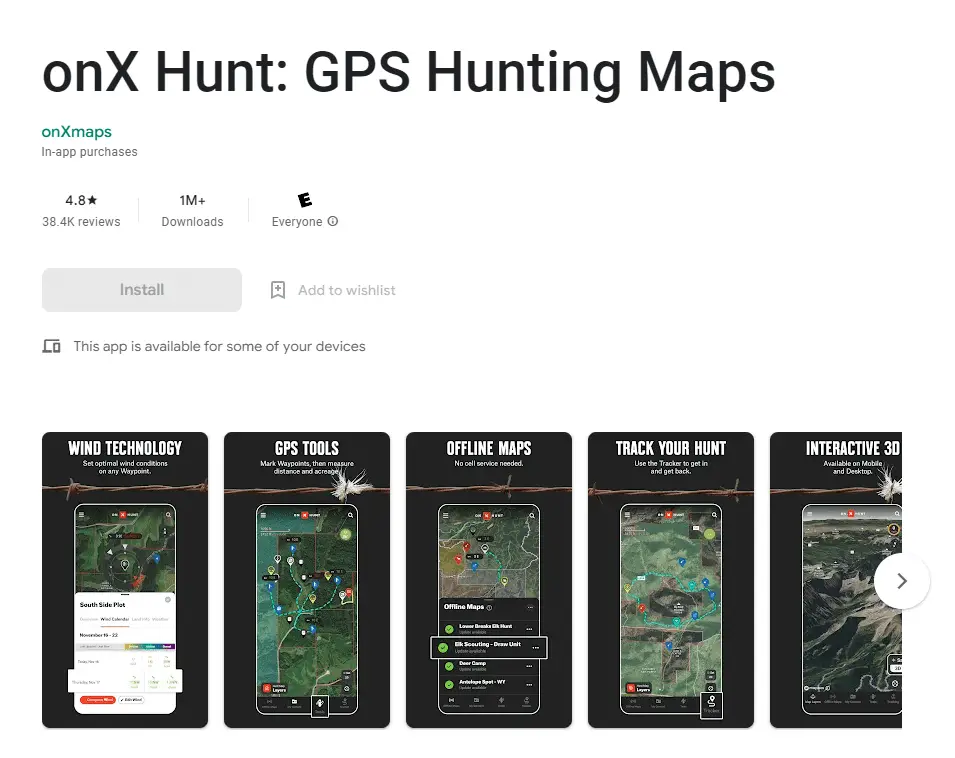
The OnX Hunt app is a good substitute for even the best hiking and hunting GPS devices, and you can choose between the Android and iPhone versions. The app also allows you to download the maps and use them offline, which is invaluable when hunting in areas with poor cell phone coverage. I also liked how easy it was to read the topography and mark specific hunting locations with custom waypoints.
The OnX Hunt app delivers detailed aerial imagery and an overview of trails, terrain, hunting units or hunting zones, and public and private boundaries that enable you to scope out new hunting locations and determine whether you are on public or private land.
This app also lists cabins, campgrounds, and other points of interest for you and your hunting party to stay safe and enjoy your time in the wilderness. You can mark tree stands and track entrance and exit routes, design food plots, and tag trail cameras and other locations critical to your hunt.
However, even though I like the OnX Hunt a lot, I have to warn you about a few hiccups. First, to gain full access to all the features, you must purchase the premium version. Also, I don’t like the fact that the satellite images are not always up to date. Finally, in my experience (and maybe that has something to do with my phone), the app drains the battery rather quickly, so you might consider bringing an extra one. Nevertheless, I would download this app again and recommend you do the same!
Pros
- Superior GPS accuracy
- Offline maps
- Allows you to map out your hunting property and save your tracks and routes
- Shows both administrative and private property boundaries and ownership data
Cons
- Not always up-to-date
- Consumes a lot of battery
If you cannot decide between OnX and HuntStand, watch the video below:
Another useful source of the info about the onX Hunt app is this article on forbes.com:
[…] what sets onX apart is the amalgamation of advantageous expert user-generated content, GPS capabilities and point-to-point navigation. Forbes.com
Check it out!
Best Free Hunting App: Quiver Hunting App

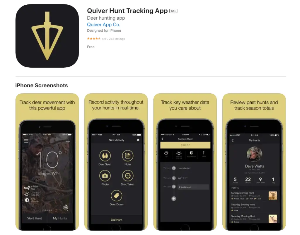
I’ve always wanted to keep a hunting journal, and thanks to the Quiver Hunting app, I can finally do that on my smartphone. The only problem is that this app is currently available only for iOS devices. Android users must wait until the company releases the appropriate version for them.
Quiver Hunting is one of the best deer hunting apps. It is a powerful in-the-field tool that helps you analyze your hunting adventures, view real-time weather conditions, and track deer movement and other key events. I recommend combining this app with some deer calls apps for the most successful deer hunting times.
The interface is user-friendly, so you should have no problem logging your deer sightings from the stand. The app will do the rest and note other relevant circumstances, such as your location, weather, wind direction, and speed. Use this data to build a timeline of your hunts and determine the best conditions and spots to shoot deer.
You can use this app to share successful hunts with other hunters via your favorite social network and upload and send them photos. The best thing about this Quiver app is that it is free, but the one thing I don’t like is that it requires cell coverage – the offline mode would make this app perfect. I recommend it to every deer hunter!
Pros
- Enables you to track key events and review past hunts
- Shows real-time weather conditions for your favorite hunting areas
- Delivers sunrise and sunset times, wind, and moon phase data
- Allows you to upload photos and take field notes
- Free
Cons
- Currently available only for iOS
- No offline mode
legendarywhitetails.com wrote a piece about the app and they mentioned that:
Its ultra-user-friendly interface allows you to track your deer and turkey hunts with just a few taps of your finger (similar to a hunting journal, only much easier to do from the stand).
legendarywhitetails.com
Check it out!
Best Paid Hunting App: Gaia GPS App
If you don’t mind spending money on a reliable GPS system, I advise you to try the Gaia GPS App. It is a renowned outdoor app that offers a wide variety of maps for both Android and iOS users. Being compatible with most Apple devices and Android smartphones and tablets, this app eliminates the need to carry a compass or a GPS device.
Gaia GPS app offers a user-friendly interface and maps of excellent quality that can replace Google Earth maps. It allows you to search waypoints and destinations directly or insert the coordinates manually. You can connect the app to other devices like Apple Watch and Apple CarPlay, too. It also allows you to save all your routes for future reference.
I like that this app can be used offline, and you need not worry about cell coverage or data usage. All you need to do is download the map that interests you before you go hunting. I also appreciate how much consideration was given to user safety. First of all, all the data is constantly updated so that there would be no unpleasant surprises.
You can access Gaia GPS for free, but if you want to enjoy it to its full potential, you must pay the premium version fee. For example, you cannot enjoy offline and specialty maps nor see private land boundaries or hunting units if you are not a premium member. Start with the free version, and then decide for yourself.
Pros
- Offers almost 2 million public overlay tracks you can access via Gaia GPS, satellite, and Gaia
- Enables you to create and save your routes and waypoints
- Download or print custom maps
- Guarantees safe off-roading
- Ability to use it offline
Cons
- Some features may not be available in certain countries
- Drains battery life
- Not available on all Android devices
Best Social Hunting App: GoWild App
If you want to connect with fellow hunters who are just as passionate as you, you must try the GoWild app. Via this social app, you can learn valuable info, get helpful tips, exchange experiences, and celebrate your success with people who share your interests!
I’ve made new friends after only a few days of using this app. You can also use it to find new hunting buddies in your proximity.
The good news is that this app is available on both the App Store and Google Play, and you can enjoy it regardless of what mobile device you own. Just download it, and you’ll get to share stories and photos of your trophies with newly-made friends on an amazing social network tailored specifically for hunters and anglers.
The GoWild app can also help you choose the best hunting gear and buy it from various dealers. If your budget is too tight for in-app purchases, you can create and share a Gear Wishlist. If you purchase new equipment, you can share your experience with others.
GoWild also features a plethora of articles and videos that can help you advance your skills and become a better hunter or angler. The good news is that GoWild is free of charge, just like most social platforms. Moreover, the more you share or purchase, the more points you earn. These points unlock valuable rewards that include gift cards too.
Pros
- Free social community that helps you improve your hunting skills
- Great for finding potential hunting partners and the best gear
- Possibility to earn rewards such as gift cards and various products
- Enables you to save hunting memories and unique stats.
- Fully customizable content
Cons
- Might share some of your data with third parties
- In-app purchases
FAQs
What is the most accurate hunting app?
HuntStand is the most accurate hunting app. Millions of satisfied users prove it. It offers excellent GPS maps, real-time weather data, and various tracking and social features. It is free, too.
What is difference between onX and HuntStand?
The main difference between onX and HuntStand is the number of mapping views they offer. Namely, OnX Hunt offers only three mapping views (satellite imagery, topographic and hybrid maps), while Huntstand delivers seven, including vivid satellite photos, public land maps, and street views.
Is HuntStand Pro free?
HuntStand Pro is not free. To unlock property boundaries, public land maps, real 3D mapping, and other premium features, you must pay a reasonable annual fee. On the bright side, the free version offers many great features too.
Is HuntStand Pro whitetail worth it?
HuntStand’s Pro Whitetail is worth it because it eliminates the need to download and pay for subscriptions to numerous other apps. It offers reliable weather predictions and mapping tools, and shows you how to best track and recover your deer.
Does onX Hunt cost money?
OnX Hunt costs money if you want to enjoy their Premium or Elite membership and use features such as trail description, off-road trails, and unlimited offline maps download. The free version offers all three mapping views (satellite, topo, and hybrid maps).
Is there a free version of onX?
There is a free version of onX, but it offers limited features. Even though it does include satellite, topographic, and hybrid maps and enables you to track your trips or add waypoints, the free version does not allow downloading offline maps or viewing off-road trails, among other things.
How accurate are property lines on hunting apps?
The property lines on hunting apps are relatively accurate but cannot compete with the accuracy of a surveyor. Best hunting apps usually offer private property boundaries that are accurate to within 5 to 10 feet.
Does onX app show property lines?
The OnX app shows property lines only if you pay for the Premium or Elite membership. A Premium membership shows you property boundaries for one state of your choice, while an Elite membership includes data for 50 states.
How close is Onx to property lines?
OnX is 5 to 10 feet close to property lines depending on the county you use it in. If the county offers inaccurate maps, the onX can be off much more – sometimes up to 100-200 feet.
How accurate is Google LandGlide?
Google LandGlide is more accurate than Google Maps since Google Maps doesn’t show all maps and boundaries the LandGlide shows. However, the LandGlide database does not represent actual recently surveyed property boundaries and cannot be used for legal purposes.
The Final Decision

Choosing the right hunting app depends on your needs and preferences and whether you are more interested in staying off private land or having an accurate weather app that guarantees a clear sky while hunting deer.
I must warn you that finding an all-in-one app might prove difficult. Luckily, there is an easy solution – download a couple of hunting apps from my list, and you are sure to enjoy a successful hunt!
Let me know if you need my assistance, and please share this article with other hunters!

Good to know the apps of 2018, specially android apps for which I was looking for. Just have one question apart from these 8 apps which apps are exists?